|
|
| RECOMMENDATIONS FOR PLANNING |  |
| | | |
 6.2.3 Green Corridors 6.2.3 Green Corridors |
In addition to the importance of green spaces for reserving fresh air corridors, their function as dividing elements in the developed landscape must be given special consideration. The effectiveness and expansiveness of green spaces go hand in hand. Sufficient proportions of green space have a climate-regulating function. In general, the provision of meadows with a thin cover of trees and shrubs is especially favorable.
Green belts are particularly suited for the separation of residential areas from emitting industrial and commercial areas as well as heavily-trafficked roads. They function as spacers, aid air exchange, and dilute air pollution (cf. Chapter 6.3.3). In addition, similar to a filter they hold back powdery pollutants. Green breaks do not only represent a dividing element of urban design, they also signify interruptions in the heat islands characteristic to built-up areas, which supports small-scale air exchange processes between the city sections they divide and between areas with differing temperatures.
Legal Bases
From an urban climate perspective, the realization of a sensible arrangement of built and unbuilt (green) spaces requires a coordinated interlinking of landscape plans / land-use plans and open-space control plans / site plans (cf. Chapter 6.1.1). Climatic and air-hygiene maps represent ľ as described in Chapter 5 ľ an indispensable technical basis in this regard.
|
|
| | | |
 |
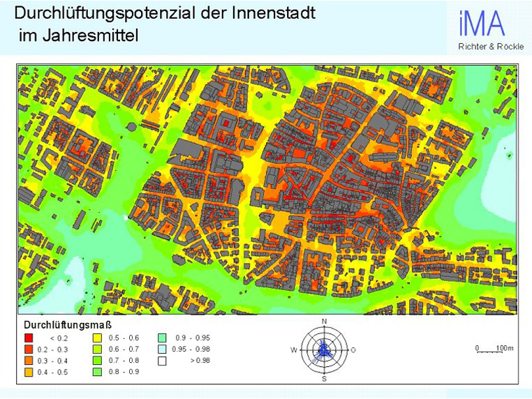
| Fig. 6/19: Aeration potential of the city center of Freiburg in the annual average (RÍCKLE & RICHTER, 2003) |
|
