|
|
| RECOMMENDATIONS FOR PLANNING |  |
| | | |
 6.1.2 Benchmarks for Describing "Green" Uses 6.1.2 Benchmarks for Describing "Green" Uses |
A quantification of the climatic effects of green areas in urban planning has already been made – as far as possible on the basis of secure knowledge – in Chapter 2. This will also play a role in the following recommendations for planning.
Various attempts have been made along the lines of green planning to quantitatively describe the vegetation potential of a land area. In this process, the non-uniformity of conceivable vegetation forms (e.g. grass, forest, potato fields, cornfields) must be considered from a climatic perspective
(Figure 6/2). In addition, it must be remembered that a living plant continuously changes: It germinates, grows, has rest and vegetation periods, loses its leaves or keeps them for many years, ages, and finally dies (GROSSMAN, 1989).
Various models assume that the ratio of vegetation to surface area of a property should be expressed through a standard defined "plant-quantity number." In this context the "green volume number (GVZ)" and the "surface function number (BFZ)" were introduced by POHL et al. (1984).
The example of the "phyto measurement number (PMZ)" according to SCHERER (1973) (see GROSSMAN, 1989) allows the principle of the plant-quantity calculation (phyto measures) to be read in the form of a defined hierarchy (Table 6/1a).
| Open ground |
0,5 |
| Lawn |
1,0 |
| Meadow |
1,5 |
| Shrub to 1 m height |
2,0 |
| Small wood to 1 m height |
3,0 |
| Hedge to 2 m height |
4,0 |
| Needle wood to 3 m height |
4,5 |
| Leaves wood to 3 m height |
5,0 |
| Needle wood 3 m to 5 m height |
6,0 |
| Leaves wood 3 m to 5 m height |
7,0 |
| Coniferous trees to 10 m height |
8,0 |
| Deciduous trees to 10 m height |
9,0 |
| Coniferous trees over 10 m height |
11,0 |
| Deciduous trees over 10 m height |
14,0 |
Table 6/1a: Phytomass numbers for various forms of vegetation
The allocation of "phyto measures" per square meter of undeveloped property area to the specified vegetation forms should concurrently describe their efficiency relative to various bio-ecologic components, including dust filtration effect, evaporation, wind protection, and shade provision.
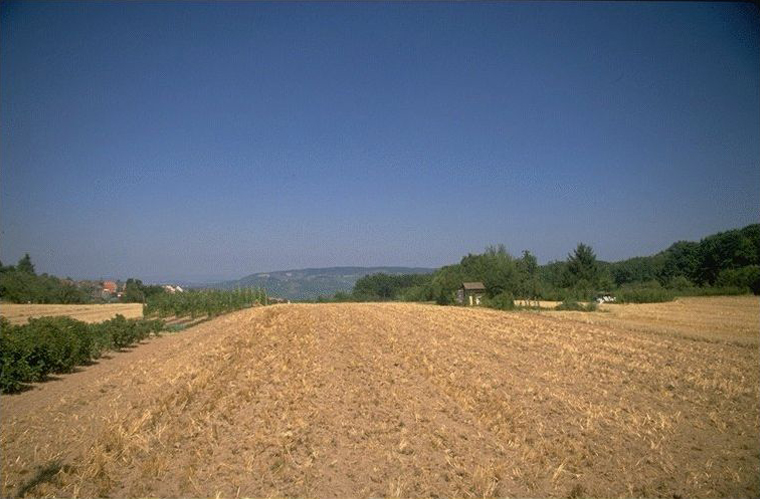
From an urban climatic perspective it should be noted that no absolute measurement value can be conceived. The various specified properties cannot be considered valid when detached from a concrete local situation and a specific problem definition. For example, grass areas (with a PMZ of only 0.5) that cool off strongly during the night exhibit a significantly large local climatic use as components of cold-air production areas (cf. Chapter 6.2.2). On the contrary, the forest (which itself should be protected), being a hindrance to airflow, has the disadvantageous property of restricting ventilation. This "disadvantage" however, is exactly the factor that produces the dust filtration effect of the forest. In the case of a lee-producing planting (cf. Chapter 3.4.2) or in the example of a "corked obstacle" as in Figure 6/17 the attainment of both desired and unintentional effects points out the difficult handling of overall climatic pros and cons. Similarly, also perceived advantages or disadvantages of street trees in this context to see location-based (see also Chapter 6.3.3 Plantations as pollution control).
|
|
| | | |
 |
| Fig. 6/2: Farmland for cold air production |
|
